|
|
April 11, 2012 Off The West Coast of Northern Sumatra earthquake and tsunami
2012-04-11 08:38:37 GMT Lat. 2.311N Long. 93.063E mb 0.0 Ms 8.6 Mw 8.6 Hmax=1.06m
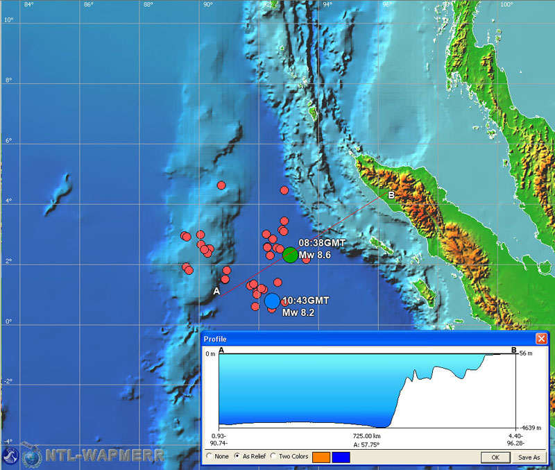
The location map of the April 11, 2012 earthquake. The large circles(blue and green) shows the positions of the main shocks as determined by NEIC.
Red circles is a first day aftershocks. The vertical cross section along line AB is shown on insert.
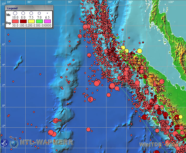
The map of historical seismicity for the period from 1499AD to present. 2681 events are shown.
|