Integrated Tsunami Research and Information System.
The full three-dimensionality and manipulation with 3D models of buildings.
The IMP_World main window shows a 3D model of the Earth surface. The cities having 3D building models are marked with colored flags.
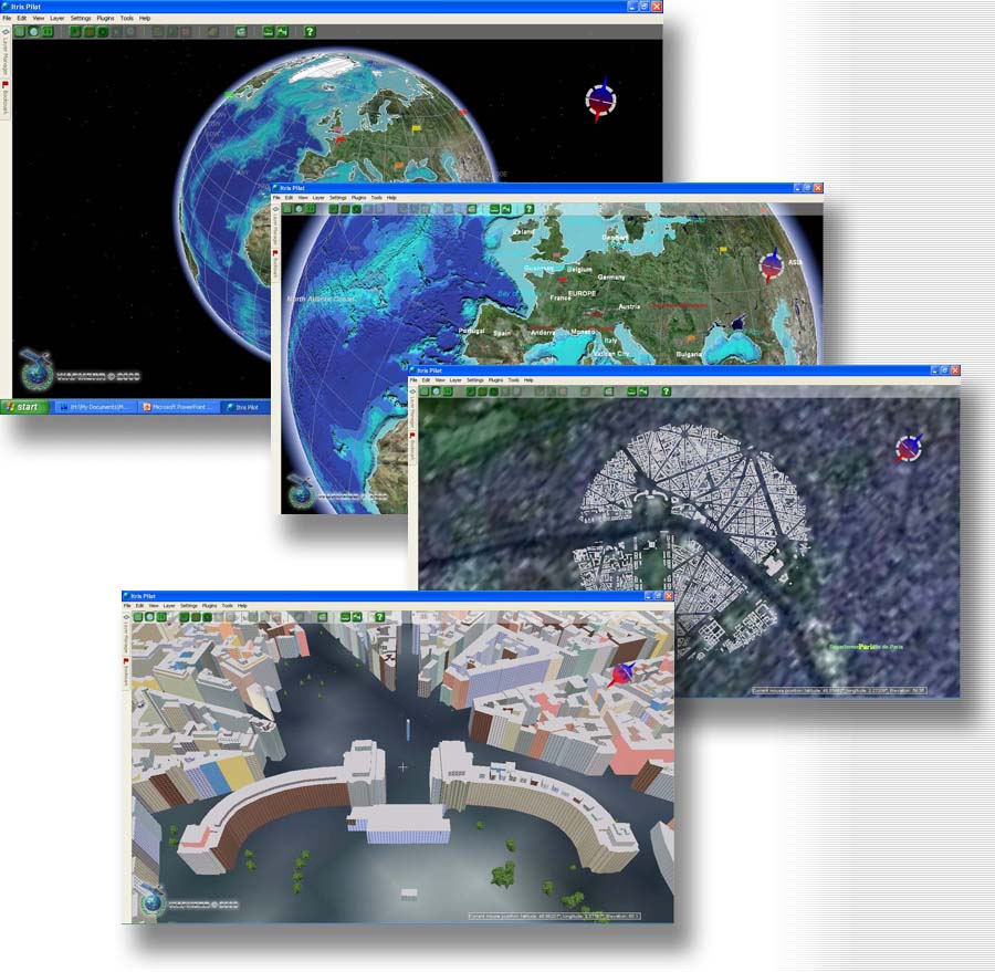
The manipulation with realistic 3D models and textures of real buildings. The IMP_WORLD provides the possibility of including real object images (people, items, signs ) in a 3D model. The building brief (address, telephone, owner) appears in the pop-up information box. (This example is Paris)
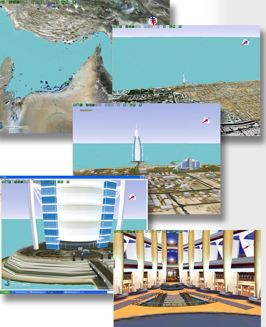
Manipulation with realistic 3D models of real buildings (this example is a model of the hotel Dubai (UAE).
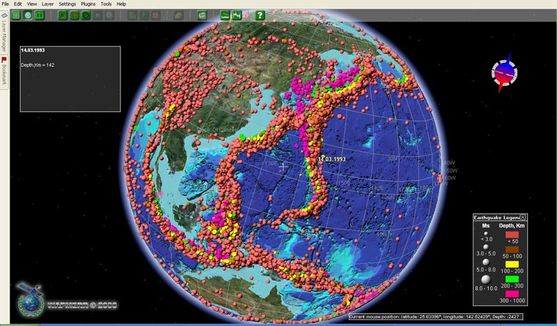
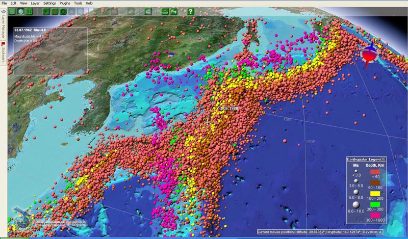
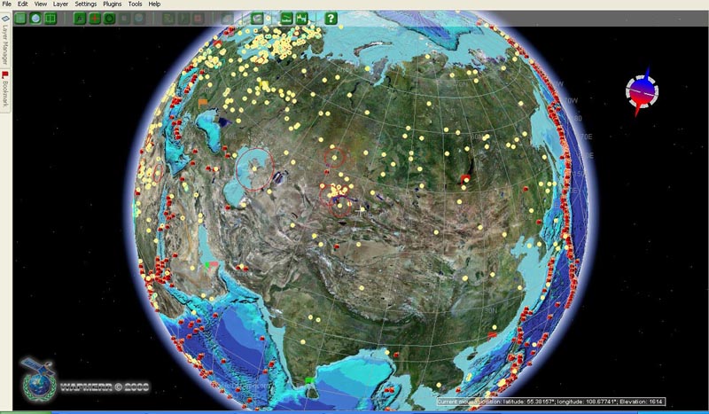
Visualization of the seismic catalogue of 1900-2007 is an example of using the IMP_World shell as a geophysical application.
Visualization of the active volcano map and impact structures map is an example of using the IMP_World shell as a geophysical application.
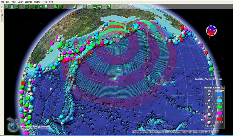
The visualization of the results of the tsunami travel time calculation caused by Simushir earthquake (13.01.2007) is an example of using the IMP_World shell for a quick tsunami forecast.
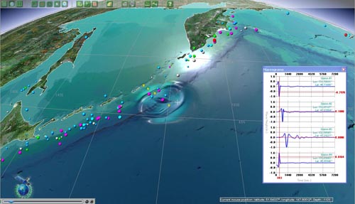
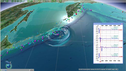
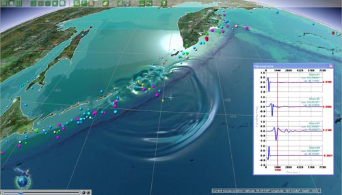
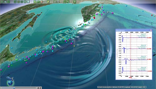
Numerical modeling of the Simushir tsunami propagation (13 Jan 2007) is an example of using the IMP_World shell as a geophysical application.
The modern geographic mapping system was developed by the Tsunami Laboratory ICMMG SD RAS in a sufficiently short time (1.5 year) and at a relatively low cost (~ 3000000 rubles). � The IMP_World has a large potential in application to the wide range of problems demanding spatial representation of heterogeneous data, its classification, handing and storage as well as visualization of the numerical modeling results.
The short-range plan is an embedding of 3D models the largest world cities and QuakeLoss system (damaging earthquake loss estimate)
in the IMP_World shell.
Development of this system is supported by the WAPMERR (World Agency for Planetary Monitoring and Earthquake Risk Reduction), Geneva, Switzerland, and group of companies InforMap (Dubai, UAE - Moscow, RF).
|