|
Many coastlines of the world exhibit sets of large V-shaped chevron-like dunes - symmetrical sand dunes that are similar in their lancet-form, showing strong parallelism, often in different angles to the shoreline (Bryant, 2001 Kelletat, Scheffers, 2003). Some examples of chevron dunes from different parts of the world ocean coastline are shown in Fig.1. The term "chevron" (specifically, "chevron-shaped pattern in the Selima sand sheet" was first used to describe wind-blown dunes by Maxwell and Haynes (1989) in south-western Egypt and the northern Sudan, where the chevrons consist of sinuous, parallel, blade-shaped deposits of sand, 10-30 cm high and 0.13-1.2 km in length, which actively migrate over darker coarse sands. Hearty et al. (1998) and Kindler and Strasser (2000) applied this term to coastal dunes. They used this term in the Bahamas to describe nested, parabolic shaped dunes formed during the Last Interglacial age and attributed them to megastorm deposits. Bryant (2001) recognized, that certain coastal chevrons could be formed by mega-tsunamis because its limits are far beyond of any storm surges reported in the literature. Only dominant winds or high-energy water currents can be responsible for formation of chevrons. In this paper, we do not limit the term "chevron" to any one process but use it in the broadest sense to refer to any sedimentary feature within the coastal landscape with this distinctive V-shape morphology.
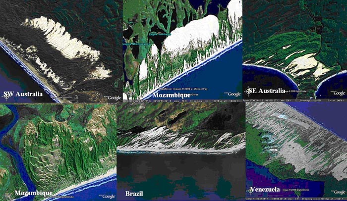
Fig.1. Examples of chevron dunes from different parts of the world ocean coastline. They reach heights of more than 100 m with in-land penetration of up to 10 km and believed to be a result of impact of destructive oceanic waves with possible later modification made by wind.
Since Google Earth satellite imagery become available in early 2005, wide distribution of chevron-type geomorphological features along many parts of World Ocean coastline (Fig.2) was quickly discovered. Actually, they can be found at almost any undisturbed coast having sufficient sand supply from beaches and shallow water areas. On aerial photographs and satellite images chevrons appear as light colored areas with fresh sand and sparse vegetation. But in many places, they are densely covered by vegetation indicating an older age. Important feature of coastal chevrons is that they consist of unsorted marine sand and quite often contain fist-sized cobbles, pieces of coral basements and mud clasts. In some cases, they are not aligned to the dominant wind direction.
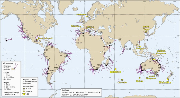
Fig.2. Location map and orientation of chevron dunes identified on satellite images.
Obviously, some chevrons have undergone a partial remobilization of sand by wind with formation of superimposed dunes of different shapes: parabolic, irregular or barchan types. The total length of chevrons, i.e. their landward extension, clearly depends upon coastal topography. Where coast is flat, larger chevrons may occur. Coastal lowlands with wide beaches are the best source areas for long chevrons, but they also exist along cliffed coast, where there is no visible source of available sand.
Most spectacular chevrons on the planet are found at the southernmost tip of Madagascar (Figs.3-6) where they reach the altitude of 205 m above present sea level with in-land penetration up to 45 km. Another impressive examples of coastal chevrons are located at the coast of the Gulf of Carpentaria (Figs. 7-9).
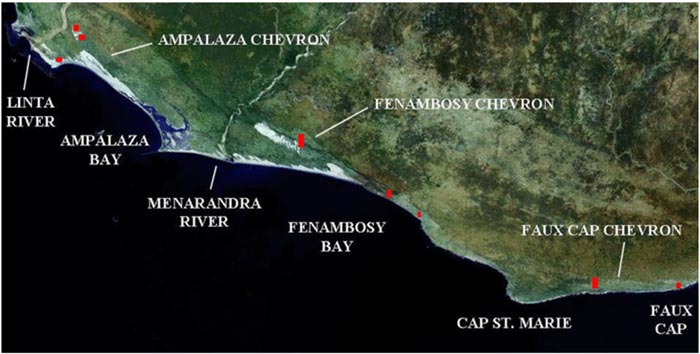
Fig.3.Five systems of chevron dunes on the southern coast of Madagascar
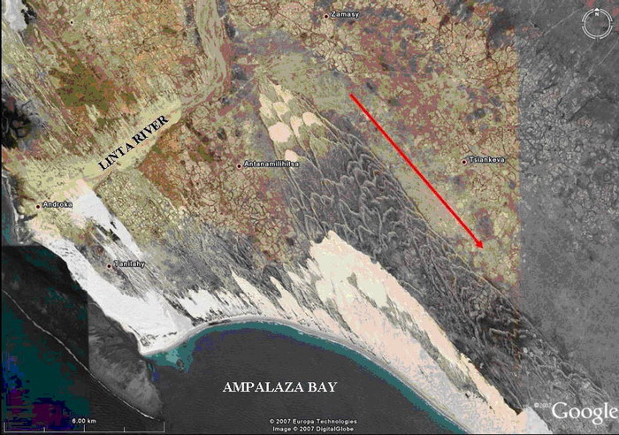
Fig. 4. Google Earth satellite image of the Ampalaza chevron, Madagascar. The chevron was created by surface water flow, also seemingly evidenced by the orientation of river bottom sediments (probable silts) smeared across floodplain terraces northwest of the Linta River, and by the orientation of smaller chevrons near the bay. The red arrow points toward the tsunami source.
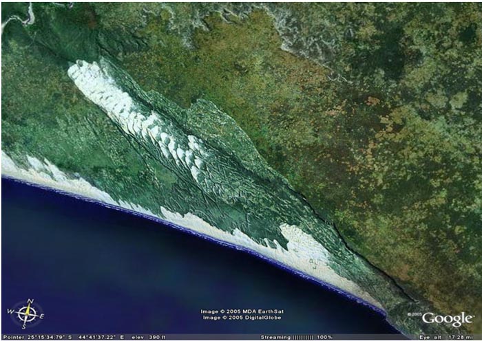
Fig.5. Fenambosy chevron. Max run-up - up to 205 m, in-land penetration - up to 35 km. The white areas at the chevron apex exhibits recent barchan dune activation made by wind.
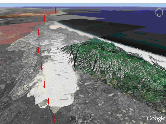
Fig.6. Oblique view looking southeast at megatsunami chevron along the coast of Fenambosy Bay. Arrows point to the top front edge of the 150-m high plateau escarpment. The green rectangle represents an area of low resolution imagery.
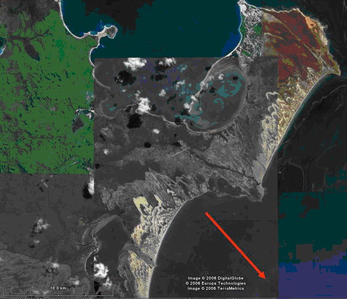
Fig. 7.Megatsunami chevron deposits on Groote Eylandt in Australia's Gulf of Carpentaria. The arrow depicts the direction of the point source of the chevrons based on chevron orientation.
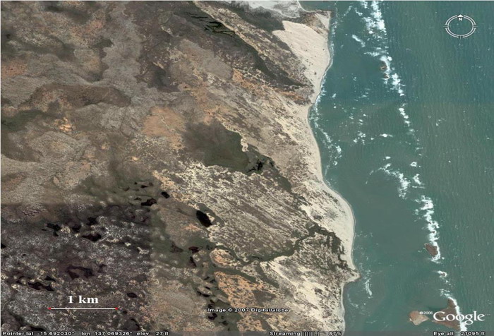
Fig. 8. Chevrons on the Vanderlin Island, near south coast of Carpentaria Gulf
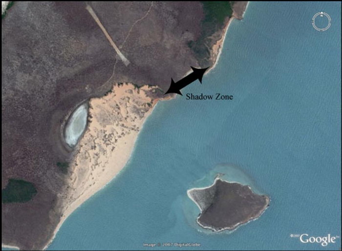
Fig. 9. Shadow effect. The island creates between chevrons on the main coastline. Large boulders and stripped soil are present on the island.
|
